Lao Cai
Lao Cai is a picturesque province located in the northwest region of Vietnam. It borders China to the north, and is well known for its stunning landscapes, diverse ethnic cultures, and rich history. Lao Cai is a popular destination for both local and international tourists, offering a unique combination of natural beauty, cultural diversity, and historical significance.
Geography and Climate
Lao Cai is famous for its mountainous terrain, with the Hoang Lien Son mountain range running through the province. The highest peak of this range is Fansipan, often referred to as the “Roof of Indochina,” standing at 3,147 meters above sea level. The province experiences a temperate climate, with cool winters and mild summers, making it an attractive destination throughout the year.
Ethnic Diversity
One of the most remarkable aspects of Lao Cai is its ethnic diversity. The province is home to various ethnic groups, including the H’mong, Tay, Dao, and Kinh people. This cultural richness is reflected in the colorful traditional costumes, festivals, and unique lifestyles of the people who call Lao Cai home. The local markets, such as the Bac Ha market, are a vibrant showcase of the province’s ethnic diversity, where visitors can interact with the locals and learn about their customs and traditions.
Tourist Attractions in Lao Cai
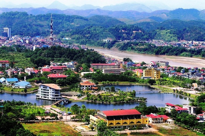
1. Lao Cai City
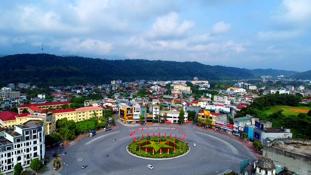
Lao Cai City is known for its many historical and cultural sites, as well as spiritual tourism, including the complex of historical monuments such as the Upper Temple, Cam Temple, Quan Temple, Double Co Temple, and Cam Lo Pagoda. Lao Cai also has an international border gate leading to the town of Hekou (China). Tourists can visit the border for a day or a few days. The Coc Leu Bridge and Coc Leu Market are also popular destinations, leaving a lasting impression on the city.
2. Sa Pa

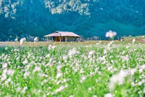
The town of Sa Pa is located at an altitude of 1,600 meters above sea level, about 40 kilometers from the center of Lao Cai City. With its cool climate, Sa Pa is ideal for summer travel. In spring, Sa Pa is adorned with the colors of peach blossoms, plum flowers, and various festivals. In autumn, Sa Pa turns golden with the harvest of terraced rice fields. In winter, from December to February, visitors may be lucky enough to experience snow and frost. Sa Pa also boasts many resorts, traditional dishes, and rich local culture.
Famous attractions in Sa Pa include: the Stone Church, Muong Hoa Valley, Ta Van Village, Ta Phin Village, Cat Cat Village, Silver Waterfall, Ham Rong Mountain, Fansipan Peak, and O Quy Ho Pass.
3. Fansipan Peak
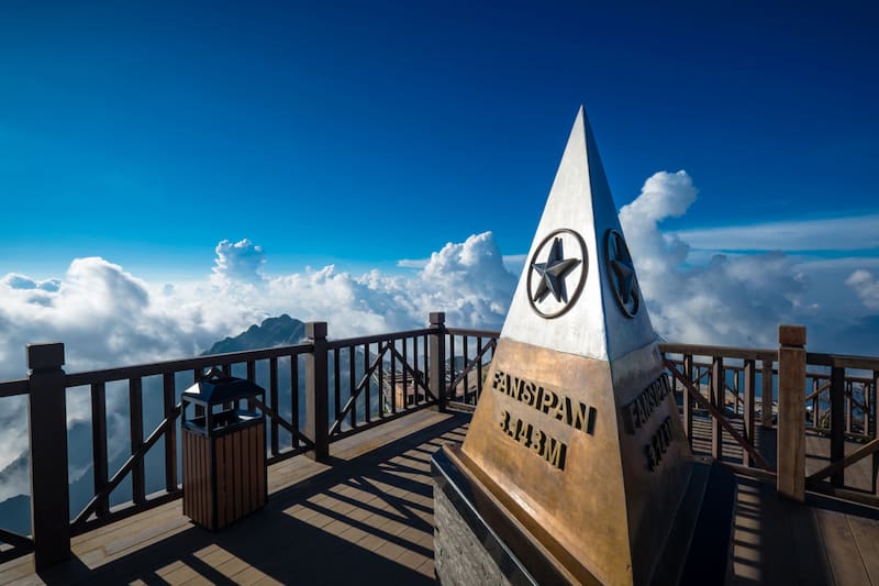
Fansipan is located in the Hoang Lien Son mountain range, straddling the provinces of Lao Cai and Lai Chau, about 9 kilometers from Sa Pa. According to the latest data from the Vietnam Surveying and Mapping Department and the Vietnam Geographic Information Center in June 2019, the peak stands at 3,147.3 meters, making it the highest in Indochina.
4. O Quy Ho Pass

O Quy Ho is one of the four famous mountain passes of Vietnam (along with Ma Pi Leng, Pha Din, and Khau Pha), situated on the border between Lai Chau and Lao Cai provinces. The pass cuts through the Hoàng Liên Sơn range and is locally known as the “Gate to the Sky.” With a length of over 50 kilometers and an altitude of nearly 2,000 meters above sea level, it is one of the longest, most dangerous, and most beautiful mountain roads in Vietnam. Visitors to Lao Cai can drive along the pass starting from Sa Pa. O Quy Ho is about 18 kilometers from the center of Sa Pa, and there are several scenic spots along the way where tourists can stop for photos.
5. Lung Po Junction
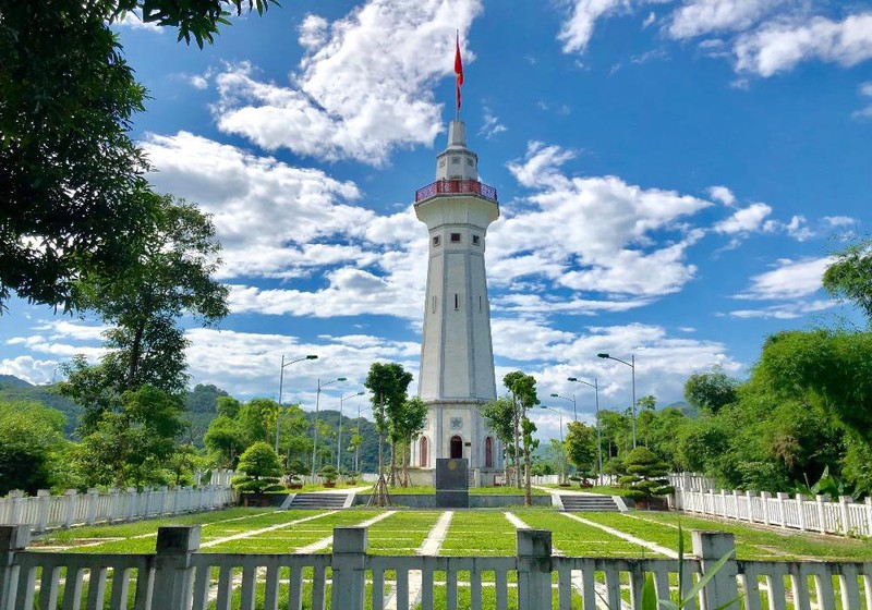
Lung Po is the name of a stream in A Mu Sung Commune, Bat Xat District. The Lung Po Stream meets the Red River at the border marker 92, marking the point where the Red River flows into Vietnam. At the confluence of the two rivers, the green water of the Lung Po Stream merges with the red waters of the Red River.
Lung Po Flagpole is a famous landmark in the area. The structure stands 31.43 meters tall, symbolizing the height of Fansipan Peak (3,143 meters). At the top is a flag measuring 25 square meters, representing the 25 ethnic groups in Lao Cai. The pathway leading to the flagpole’s summit has 125 spiral steps. To reach Lung Po, tourists must pass through many winding mountain roads, so caution is required when traveling.
6. Y Ty
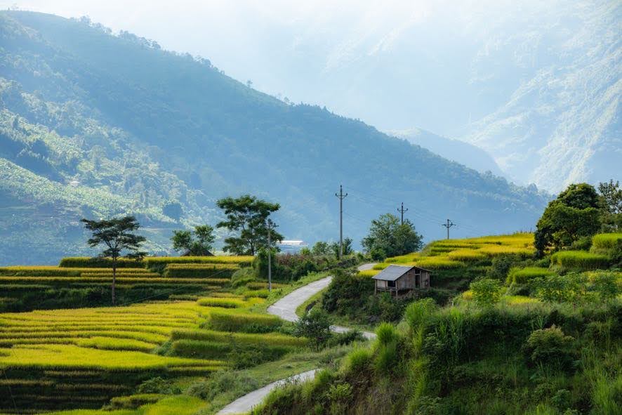
Y Ty is a border commune in Bat Xat District, situated at an altitude of over 2,000 meters above sea level. It is one of the best cloud-hunting spots in Vietnam. From October to March, and from September to October, Y Ty offers the most beautiful views of golden rice fields in season.
Y Ty is about 90 kilometers from Lao Cai City, via the Bat Xat – Trinh Tuong – Lung Po – A Mu Sung – A Lu – Ngai Thau route. Visitors can also reach Y Ty from Sa Pa through the Ban Khoang – Ta Giang Phin – Ban Xeo – Muong Hum – Sang Ma Sao route, which is about 70 kilometers. Both routes are difficult to travel, with poor roads, many potholes, and muddy conditions if it rains. Key activities in Y Ty include the Mường Hum market, which is held only on Sunday mornings. A stroll and rice field viewing in Choan Then Village is also an ideal option.